2. Integrating workflow into existing projects
Download page as PDFMany organizations want to incorporate open mapping into their operations but don’t know where to start, believe that it requires rebuilding workflows from scratch, or that their operations will not be able to integrate open mapping. However, the open mapping workflow can be, and should be, integrated into existing workflows. The first step towards using open mapping is analyzing how existing projects and workflows can be altered and improved with integration.
2.1 Survey form conversion
Survey and data collection are often critical to operations. While paper surveys have been the standard for data collection, many disadvantages of paper surveys (i.e. data quality) have been resolved with the introduction of digital surveying. Converting from traditional paper surveys and data collection to digital surveying and mobile data collection can reduce costs, improve speed and efficiency, and increase overall data quality. Using digital methods also allows for more flexibility, customization, and enhanced management of fieldwork. As digital surveys allow for GPS point collection, converting existing surveys to a digital format improves the ability for survey data to be analyzed geospatially with higher accuracy.
Benefits of Converting Surveys to Digital Forms:
Steps Necessary to Convert Surveys to Digital Forms:
- Determine with digital survey tool is right for your organization. See Section to learn more about various data collection applications and their differences.
- Determine what hardware you need or if hardware available to you is appropriate for the digital survey tool.
- For building and converting forms for ODK, training materials can be found here: https://docs.google.com/presentation/d/1Ngkz5pmcWr5z-15gfLVNqau8klxJRu9OgRrrXBHEaKk/edit#slide=id.g5559eccd29_0_34
- For building and converting forms for KoboCollect, training materials can be found here: https://docs.google.com/presentation/d/1aQzOfgZtDzx3YYhw6qP99bKSzMmq6s-8bZ5HiJYUTsw/edit#slide=id.g55c75f85bc_0_380
2.2 Upload existing data to OSM (and other open data platforms)
From school facility data to WaSH points, many organizations already possess geospatial (and non-geospatial) data that is critical to areas such as operations, and monitoring and evaluation. Existing data can be imported into OpenStreetMap, but should be handled carefully. Importing data needs to be planned and executed following specific guidelines and methodology, as this data could have significant impact on existing data in OSM.
For each dataset imported, the OSM Import Guidelines created by the OSM community must be strictly followed and integrated into your organizations import methodology. The OSM Import guidelines include:
- Prerequisites
- Community Buy-in
- License Approval
- Documentation
- Import Review
- Uploading
For the full OSM Import Guidelines visit wiki.openstreetmap.org/wiki/Import/Guidelines
In addition to following the Import Guidelines, it is critical that any personally identifiable information is removed from datasets prior to upload to OSM.
2.3 Downloading data from OSM & benefits
OpenStreetMap (OSM) is a great source to explore the data available in a given place when initiating a new project because it offers vast, detailed datasets from all over the world. Because OSM data is free to use and it is accessible and downloadable by anyone, the platform contains data that is more rich and detailed than found in other free map sources. The ability for NGOs, partners and local government to be able to download OSM data to support their work is especially beneficial for the following reasons:
- Location of features, services or amenities can quickly be searched, interpreted and displayed for stock-taking (what is and isn’t available) and downloaded for further use
- Availability and quality of data can guide your organization in designing and implementing its open mapping project to complement ongoing mapping efforts
- You can contribute your organization’s own data to the OSM platform to expand the reach of the data’s usability and impact by other partners or local government authorities working on similar issues \
How do you download data from OSM?
Data Export Tools allow users to download OSM data for use and analysis programs such as QGIS. The following are Data Export Tools commonly used in the HOT workflow. For more information on how to use these tools, use the training materials linked below.
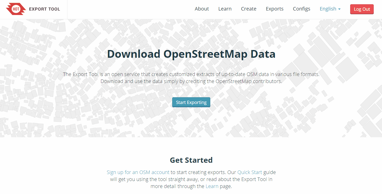
HOT Export Tool
HOT Export Tool allows users to download OSM data by specifying tags, area of interest, and file type. Learning resources and walkthroughs can be found at the HOT Export Tool Learn page.
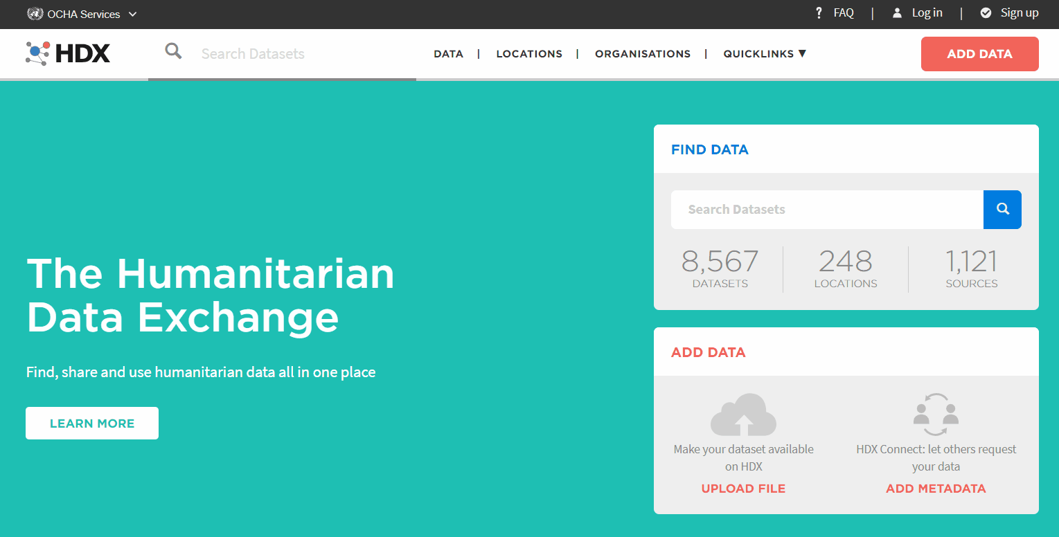
Humanitarian Data Exchange (HDX)
Humanitarian Data Exchange (HDX) is a data platform for storing and sharing humanitarian data managed by OCHA’s Centre for Humanitarian Data.
Training Materials
Data Export Tools Presentation - English
HOT Export Tool Worksheet - English