Goal 6 - Clean Water and Sanitation
Download page as PDFEnsure access to water and sanitation for all
“Clean, accessible water for all is an essential part of the world we want to live in and there is sufficient fresh water on the planet to achieve this. However, due to bad economics or poor infrastructure, millions of people including children die every year from diseases associated with inadequate water supply, sanitation and hygiene. Water scarcity, poor water quality and inadequate sanitation negatively impact food security, livelihood choices and educational opportunities for poor families across the world.”
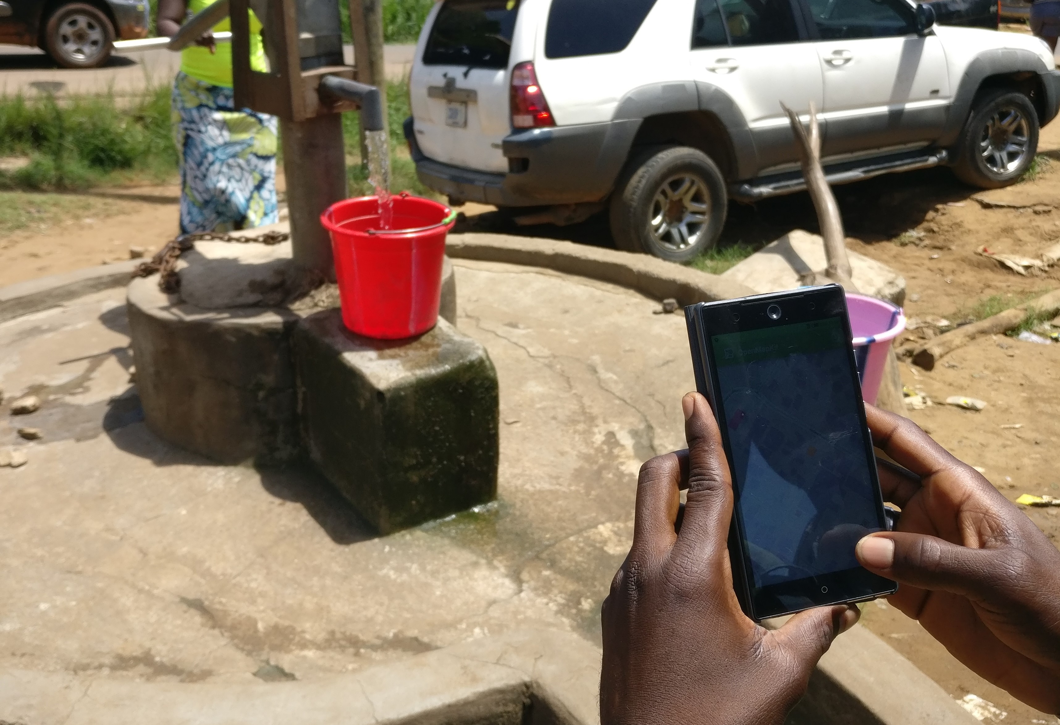
Visualizing sanitation access and quality through mapping infrastructure like water points helps identify areas at risk from water-borne diseases, and improve local sanitation and waste management systems. In addition to the location of features such as latrines and bore-holes, critical attribute information can be mapped such as operational status, proneness to flooding, accessibility, and whether or not the feature is lit at night.
What has been done?
Ramani Huria: Using fresh and innovative approaches can help reduce risks from urban flooding in an environment of rapid urbanization. is combining exposure data and flood hazard data to conduct risk analysis of potential future disasters. The team are using community mapping techniques to engage with local leaders and teach community inhabitants free, open source data collection tools from their smartphones. The data collected is enabling people across all levels of society to improve flood mitigation plans and raise awareness and resiliency to natural threats.
Mapping Arsenic Contamination: The Asian University for Women (AUW) YouthMappers team in Bangladesh, the first all women’s YouthMappers chapter in the world, gathered field data from deep tube-wells in Barayadala, Sitakunda where arsenic contamination affects water sources. The data they collected on arsenic-contaminated wells can be visualized on maps to help the government and NGOs to locate affected areas, improving the provision of safe drinking water for people living in affected communities.
What else could be mapped?
- Map locations where lack of access or broken equipment is a problem
- Map water points and quality within refugee camps to understand distribution of and access to safe drinking water
- Map latrines, public toilets, and other facilities as well as attributes to understand distribution of and access to sanitation facilities
- Conduct participatory mapping activities to map out flood and hazard history to understand which water and sanitation facilities are at risk